
Unlocking Precision and Safety:The Role of Professional Drones in Inspection
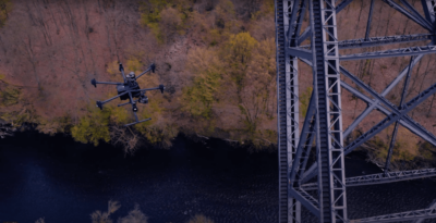
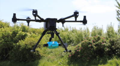
Deploying drones for inspection becomes increasingly evident, particularly in accessing and examining challenging environments such as bridges, monuments, antennas, wind parks, and solar panel fields.
- Access hard to reach areas
- Precise results through high-resolution and thermal cameras
- Avoid accidents and enhance labor safety
E20PRO
The E20Pro empowers professionals to make the invisible visible with a waterproof and high-resolution thermal camera. It enables to detect cracks and thermal bridges in diverse environments.
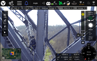
- dual-camera The dual-camera system lets you swap easily between the standard RGB and the thermal camera during the flight. It provides comprehensive inspection documentation in JPEG and MP4 format.
- high-resolution The high-resolution capabilities of the E20PRO ensure clarity and detail in imaging, enabling inspectors to identify subtle irregularities
- waterproof Waterproof -the E20Pro allows a seamless operation in a variety of environments, ensuring consistent performance in changing weather conditions.
Take the plunge into the unseen!
Get it now!
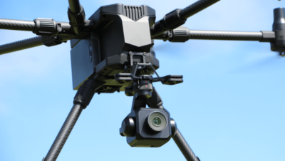
Oblique Camera
Take pictures from five different angles in one single flight only.
With 125 million pixels, the Oblique Camera redefines high resolution in aerial imaging.
- Flight Accuracy: 3 cm flight accuracy, ensuring pinpoint precision in every aerial endeavour.
- Elevation Accuracy: 5 cm elevation accuracy, delivering reliable and detailed topographic data.
- Impressive Airspeed: Navigate through projects seamlessly with an airspeed of 10m/s, enhancing efficiency in data acquisition.
Ready to transform Your Aerial Inspections?
Get it now!
E45S
Your essential tool for inspection!
The camera redefines high resolution in aerial imaging with the 45MP full frame sensor.
- High Precision The E45S ensures accuracy through a full-frame sensor that delivers the highly detailed images.
- Distortion-Free Imagery: With its 3-axis stabilized gimbal, the E45S guarantees distortion-free shots, providing you with imagery that is sharp and perfectly aligned.
- Many Application Options: Whether overseeing a construction site, conducting land surveys, analyzing environmental data, or inspecting structures like building facades or wind turbines, the E45S is your trusted companion for accurate and reliable data.
Ready to improve your aerial efforts with Yuneec's E45S?
Get it now!
Discover our solutions and get results like never before with the Yuneec system and accompanying payloads – your gateway to accurate and reliable aerial data.

Would you like to Transform Your Aerial Surveying Experience? To explore the possibilities
Contact US today!
This site is registered on wpml.org as a development site. Switch to a production site key to remove this banner.